|
|
|
|
|
|
|
|
|
|
|
|
|
|
|
|
|
|
|
|
|
|
|
|


GALLERY
OF PHOTOS — click
a thumbnail for a larger version
Curtis Ridge
![]()
![]()
![]()
![]()
![]()
![]()
![]()
![]()
![]()
![]()
![]()
![]()
![]()
![]()
![]()
![]()
|
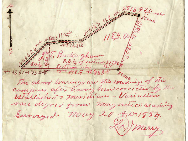
Like the vast majority of their neighbors, the Buckinghams were farmers. Their home was on Curtis Ridge, which had been named after Mary's family. In the spring of 1884, surveryor L.D. Merry plotted an 11.84-acre piece of their property, located across the road from the cemetery.
(TEXT
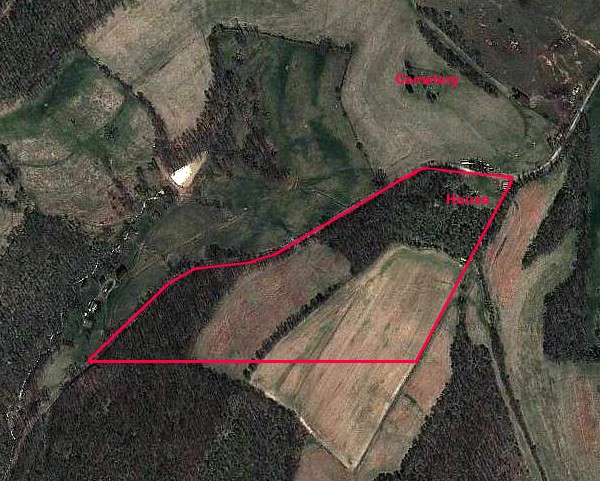
CONTINUED BELOW) Here are the surveyor's lines laid over a 2011 Google Earth view of the Ridge.
(TEXT
CONTINUED BELOW)
Below
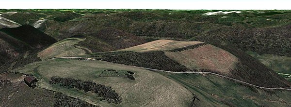
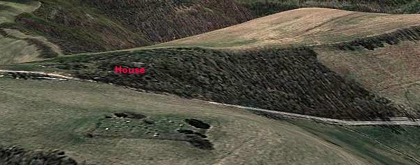
we see an overview of the Ridge looking south, from that 2011 image
with elevations doubled. As we zoom in, the hilltop cemetery is
in the foreground, and J.T. Buckingham's property is across the road
in the background.
|