|
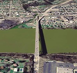
The
George D. Stuart Bridge was built in 1952 as a toll bridge across
the Allegheny River. On the right, it's seen in a Google Earth
image. As you can tell from the bridge's shadow, it's
considerably higher on the near side (the bluffs of New Kensington,
elevation 925 feet) than on the far side (the flats of Tarentum,
elevation 748 feet).
I
moved to this area in 1980. The toll had long been removed,
but the bridge deck had not yet been widened from three lanes to
four. That first December, a snowstorm during the evening rush
hour tied up traffic for hours. Cars with rear-wheel drive had
great difficulty making it up the long icy slope. Fortunately,
I haven't encountered that situation since.
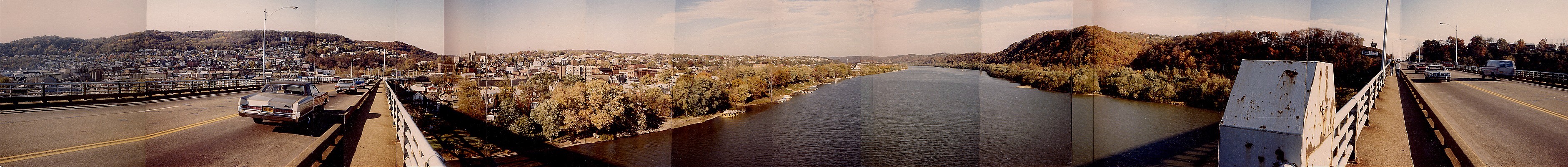
I
shot the above panorama from the bridge the following autumn,
October 1981.
|